
2019 Map of Jourdanton
USGS Topo · Published 2019About this map
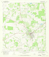
Jourdanton serves as a primary hub in South Texas, where a grid of residential streets and county roads radiates into the ranchlands of Atascosa County. The landscape is defined by the drainage of the Atascosa River and its various tributaries, including Salt Br and Bonita Cr. This modern survey illustrates the proximity between the central town and the neighboring community of Pleasanton, connected by a network of established routes like Old Pearsall Rd and Bluntzer Rd.
Find a feature on this map
109 named features on this map. Tap any name to fly to it.
Don’t see what you’re looking for? This feature index may not catch every label — zoom into the map to look around manually.
Map Details
Editions of this 2019 Jourdanton Map
This is the sole edition of this map. No revisions or reprints were ever made.
Other maps of this area

1953 · Crystal City
USGS Topo · 1:250,000

1954 · San Antonio
USGS Topo · 1:250,000

1955 · Crystal City
USGS Topo · 1:250,000

1956 · Pleasanton
USGS Topo · 1:62,500

1956 · Jourdanton
USGS Topo · 1:62,500

1957 · San Antonio
USGS Topo · 1:250,000

1961 · Crystal City
USGS Topo · 1:250,000

1964 · Leming
USGS Topo · 1:24,000

1968 · Crystal City
USGS Topo · 1:250,000
1968 · Jourdanton
USGS Topo · 1:24,000