
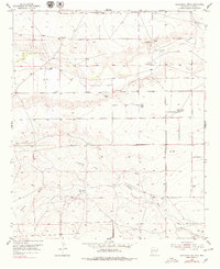
1949 Map of Juan Lake
USGS Topo · Published 1949About this map
Walker Air Base Auxiliary Landing Field No 1 occupies the northeastern corner of this landscape, marking a period of military aviation expansion in Chaves County following the war. The terrain is defined by a network of drainage channels including Thirteenmile Draw, Zubi Draw, and Made Draw, which cut through the arid plains toward seasonal catchments like Juan Lake and Antelope Lake.
Find a feature on this map
17 named features on this map. Tap any name to fly to it.
Don’t see what you’re looking for? This feature index may not catch every label — zoom into the map to look around manually.
Map Details
Editions of this 1949 Juan Lake Map
This is the sole edition of this map. No revisions or reprints were ever made.
Other maps of this area

1949 · Hondo Reservoir
USGS Topo · 1:24,000

1949 · Peters Lake
USGS Topo · 1:24,000

1949 · Roswell South
USGS Topo · 1:24,000

1955 · Hackberry Ranch
USGS Topo · 1:24,000

1955 · Kincaid Ranch
USGS Topo · 1:24,000

1955 · Roswell
USGS Topo · 1:250,000

1956 · Diamond A Ranch
USGS Topo · 1:24,000

1958 · Roswell
USGS Topo · 1:250,000
1959 · Hackberry Ranch
USGS Topo · 1:24,000

1959 · Diamond A Ranch
USGS Topo · 1:24,000