
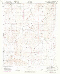
1949 Map of Hondo Reservoir
USGS Topo · Published 1949About this map
The Hondo Reservoir and the Hondo Irrigation Project dominate this arid Chaves County landscape, appearing here as inactive features of the mid-century water infrastructure. The survey reveals a complex network of dry-land engineering, including the Hondo Reservoir Diversion Canal, the Outlet Canal, and various water controls along the Rio Hondo.
Find a feature on this map
23 named features on this map. Tap any name to fly to it.
Don’t see what you’re looking for? This feature index may not catch every label — zoom into the map to look around manually.
Map Details
Editions of this 1949 Hondo Reservoir Map
2 editions found
Other maps of this area

1949 · Peters Lake
USGS Topo · 1:24,000

1949 · Roswell North
USGS Topo · 1:24,000

1949 · Roswell South
USGS Topo · 1:24,000

1949 · Juan Lake
USGS Topo · 1:24,000

1949 · Corn Ranch
USGS Topo · 1:24,000

1950 · Corn Ranch
USGS Topo · 1:24,000

1955 · Roswell
USGS Topo · 1:250,000

1956 · Diamond A Ranch
USGS Topo · 1:24,000

1958 · Roswell
USGS Topo · 1:250,000

1959 · Diamond A Ranch
USGS Topo · 1:24,000