
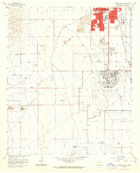
1949 Map of Corn Ranch
USGS Topo · Published 1977About this map
Corn Ranch sits within a landscape defined by seasonal drainages and isolated water sources in this late 1940s topographical record. The map reveals the essential infrastructure of ranching life in Chaves County, where survival depended on careful water management and established routes through the arid terrain. Names like Corn Ranch represent the enduring settlement patterns of the region, anchored by the necessity of dependable ground points for livestock and family life. This survey provides a precise look at the land's contours and the scattered improvements that connected this remote portion of New Mexico to the wider county and regional economy before the onset of modern expansion.
Find a feature on this map
1 named feature on this map. Tap any name to fly to it.
Don’t see what you’re looking for? This feature index may not catch every label — zoom into the map to look around manually.
Map Details
Editions of this 1949 Corn Ranch Map
This is the sole edition of this map. No revisions or reprints were ever made.
Other maps of this area

1949 · Hondo Reservoir
USGS Topo · 1:24,000

1949 · Roswell North
USGS Topo · 1:24,000

1949 · Roswell South
USGS Topo · 1:24,000

1950 · Corn Ranch
USGS Topo · 1:24,000

1955 · Roswell
USGS Topo · 1:250,000

1956 · Diamond A Ranch
USGS Topo · 1:24,000

1958 · Roswell
USGS Topo · 1:250,000

1959 · Diamond A Ranch
USGS Topo · 1:24,000

1962 · Roswell
USGS Topo · 1:250,000
1962 · Roswell South
USGS Topo · 1:24,000