
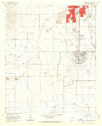
1950 Map of Corn Ranch
USGS Topo · Published 1950About this map
Corn Ranch serves as the focal point for this ranching landscape in Chaves County, mapped during a period when water access dictated the survival of rural New Mexico outposts. The topography is defined by significant drainage systems, including South Berrendo Creek, Blackwater Draw, and Eightmile Draw, which are supported by a complex network of private water improvements. The map identifies several named water sources such as Rosenberg Well, Berry Well, and Middle Well, alongside a prominent Diversion Ditch near the southern boundary. Transportation through this arid terrain relied on the Roswell-Pine Lodge Road, which provided a critical link across the hills. The presence of Windmill (Aband) and Tank (Aband) labels suggests shifting patterns in land use and water management at the mid-century mark.
Find a feature on this map
22 named features on this map. Tap any name to fly to it.
Don’t see what you’re looking for? This feature index may not catch every label — zoom into the map to look around manually.
Map Details
Editions of this 1950 Corn Ranch Map
This is the sole edition of this map. No revisions or reprints were ever made.
Other maps of this area

1949 · Hondo Reservoir
USGS Topo · 1:24,000

1949 · Roswell North
USGS Topo · 1:24,000

1949 · Roswell South
USGS Topo · 1:24,000

1949 · Corn Ranch
USGS Topo · 1:24,000

1955 · Roswell
USGS Topo · 1:250,000

1956 · Diamond A Ranch
USGS Topo · 1:24,000

1958 · Roswell
USGS Topo · 1:250,000

1959 · Diamond A Ranch
USGS Topo · 1:24,000

1962 · Roswell
USGS Topo · 1:250,000
1962 · Roswell South
USGS Topo · 1:24,000