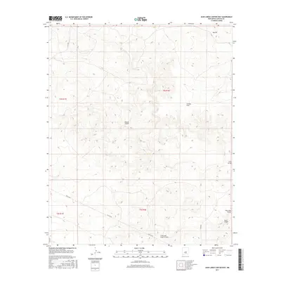
2017 Map of Juan Largo Canyon East
USGS Topo · Published 2017About this map
Juan Largo Canyon and its many tributaries carve through this high-desert landscape in Lincoln County, reflecting a complex drainage system characteristic of the New Mexico interior. The terrain is marked by significant topographical shifts, from the prominent elevation of Gyp Hill in the north to the winding paths of Cowboy Draw and Wildcat Canyon. Modern infrastructure is represented by the extensive Pipe Line Rd, which traverses the southern portion of the quadrangle alongside established county routes like Co Rd 8026. The map illustrates a rural environment where land use is dictated by the rugged hydrology of South Canyon, Gallo Arroyo, and Little Juan Largo Canyon, providing a detailed view of the region's physical geography and transit corridors.
Find a feature on this map
14 named features on this map. Tap any name to fly to it.
Don’t see what you’re looking for? This feature index may not catch every label — zoom into the map to look around manually.
Map Details
Editions of this 2017 Juan Largo Canyon East Map
This is the sole edition of this map. No revisions or reprints were ever made.
Other maps of this area

1954 · Fort Sumner
USGS Topo · 1:250,000

1955 · Roswell
USGS Topo · 1:250,000

1958 · Fort Sumner
USGS Topo · 1:250,000

1958 · Roswell
USGS Topo · 1:250,000

1962 · Roswell
USGS Topo · 1:250,000

1967 · North Lake
USGS Topo · 1:24,000

1967 · Chivata Canyon
USGS Topo · 1:24,000

1967 · Ramon SW
USGS Topo · 1:24,000

1979 · Fort Sumner
USGS Topo · 1:100,000
1979 · Salt Creek
USGS Topo · 1:100,000