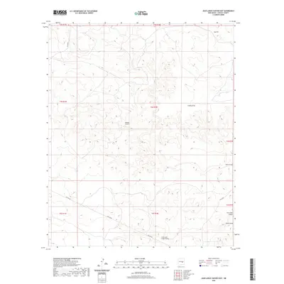
2020 Map of Juan Largo Canyon East
USGS Topo · Published 2020About this map
Juan Largo Canyon and its smaller counterpart, Little Juan Largo Canyon, define the drainage patterns of this high-desert landscape in Lincoln County. The map reveals a network of deep-cut dry washes and drainage systems, including South Canyon and Wildcat Canyon, which carve through the terrain. The infrastructure of the area is characterized by utility-focused development, most notably the long stretch of Pipe Line Rd and scattered county access routes like Co Rd B020. Prominent elevations like Gyp Hill and the winding Gallo Arroyo illustrate the complex topography. This survey highlights the intersection of modern industrial utility corridors with traditional land management divisions, as seen in the grid of township and range boundaries that overlay the natural features of the New Mexico interior.
Find a feature on this map
18 named features on this map. Tap any name to fly to it.
Don’t see what you’re looking for? This feature index may not catch every label — zoom into the map to look around manually.
Map Details
Editions of this 2020 Juan Largo Canyon East Map
This is the sole edition of this map. No revisions or reprints were ever made.
Other maps of this area

1954 · Fort Sumner
USGS Topo · 1:250,000

1955 · Roswell
USGS Topo · 1:250,000

1958 · Fort Sumner
USGS Topo · 1:250,000

1958 · Roswell
USGS Topo · 1:250,000

1962 · Roswell
USGS Topo · 1:250,000

1967 · North Lake
USGS Topo · 1:24,000

1967 · Chivata Canyon
USGS Topo · 1:24,000

1967 · Ramon SW
USGS Topo · 1:24,000

1979 · Fort Sumner
USGS Topo · 1:100,000
1979 · Salt Creek
USGS Topo · 1:100,000