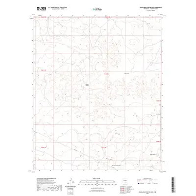
2023 Map of Juan Largo Canyon East
USGS Topo · Published 2023About this map
Juan Largo Canyon and its smaller counterpart, Little Juan Largo Canyon, form the primary drainage system in this high-desert portion of Lincoln County. The landscape is defined by its dramatic topographic relief, including Gyp Hill in the northeast and a series of rugged draws and canyons like Wildcat Canyon and South Canyon. These natural corridors dictate the layout of the minimal road network, which consists of unpaved routes such as Co Rd 8020 and Co Rd 8026.
Find a feature on this map
18 named features on this map. Tap any name to fly to it.
Don’t see what you’re looking for? This feature index may not catch every label — zoom into the map to look around manually.
Map Details
Editions of this 2023 Juan Largo Canyon East Map
This is the sole edition of this map. No revisions or reprints were ever made.
Other maps of this area

1954 · Fort Sumner
USGS Topo · 1:250,000

1955 · Roswell
USGS Topo · 1:250,000

1958 · Fort Sumner
USGS Topo · 1:250,000

1958 · Roswell
USGS Topo · 1:250,000

1962 · Roswell
USGS Topo · 1:250,000

1967 · North Lake
USGS Topo · 1:24,000

1967 · Chivata Canyon
USGS Topo · 1:24,000

1967 · Ramon SW
USGS Topo · 1:24,000

1979 · Fort Sumner
USGS Topo · 1:100,000
1979 · Salt Creek
USGS Topo · 1:100,000