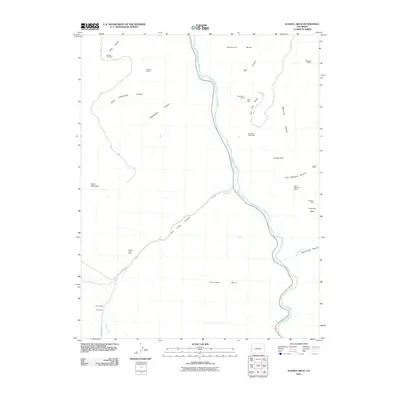
2010 Map of Juanita Arch
USGS Topo · Published 2010About this map
Dolores River canyon country dominates this 2010 topographic survey of Mesa County, revealing a landscape heavily shaped by uranium and vanadium mining history. The map traces the winding river corridor as it cuts between massive landforms like Tenderfoot Mesa and Sewemup Mesa, with the iconic Juanita Arch standing as a notable natural landmark on the eastern cliffs. The area is dense with named mining claims, reflecting decades of extraction efforts in the Colorado Plateau. Prominent sites include the Big Indian Lease Mine on Flat Top Mesa, the Mother Dee Mine near Cave Canyon, and the Copper Rivet Mine at the western edge of Salt Creek Canyon. This survey provides a clear look at the network of remote access roads, such as Z 2/10-Z 5/10 RD, that connect these high mesas and deep drainages like Sinbad Valley.
Find a feature on this map
31 named features on this map. Tap any name to fly to it.
Don’t see what you’re looking for? This feature index may not catch every label — zoom into the map to look around manually.
Map Details
Editions of this 2010 Juanita Arch Map
This is the sole edition of this map. No revisions or reprints were ever made.
Other maps of this area

1885 · La Sal
USGS Topo · 1:250,000

1916 · Paradox Valley
USGS Topo · 1:125,000

1922 · Paradox Valley
USGS Topo · 1:125,000

1948 · Roc Creek
USGS Topo · 1:24,000

1949 · Roc Creek
USGS Topo · 1:24,000

1949 · Juanita Arch
USGS Topo · 1:24,000

1949 · Red Canyon
USGS Topo · 1:24,000

1949 · Calamity Mesa
USGS Topo · 1:24,000

1949 · Gateway
USGS Topo · 1:24,000

1950 · Juanita Arch
USGS Topo · 1:24,000