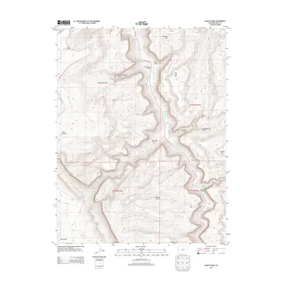
2013 Map of Juanita Arch
USGS Topo · Published 2013About this map
The Dolores River carves a deep path through Mesa County in this 2013 topographic study, revealing a landscape defined by dramatic erosional features and high-desert mesas. The namesake Juanita Arch stands north of Little Maverick Canyon, part of a complex system of drainages including Bull Canyon and Cottonwood Canyon that feed toward the river corridor. Co 141 provides the primary access through this remote terrain, following the river's winding course past landmarks like Sewemup Mesa and Calamity Mesa. The map illustrates the stark geological transition into Sinbad Valley at the southwestern corner, while prominent elevations like Cone Mountain and Tenderfoot Mesa dominate the skyline. This document offers a precise look at the intersecting canyons and high plateau country before the modern landscape was further altered.
Find a feature on this map
26 named features on this map. Tap any name to fly to it.
Don’t see what you’re looking for? This feature index may not catch every label — zoom into the map to look around manually.
Map Details
Editions of this 2013 Juanita Arch Map
This is the sole edition of this map. No revisions or reprints were ever made.
Other maps of this area

1885 · La Sal
USGS Topo · 1:250,000

1916 · Paradox Valley
USGS Topo · 1:125,000

1922 · Paradox Valley
USGS Topo · 1:125,000

1948 · Roc Creek
USGS Topo · 1:24,000

1949 · Roc Creek
USGS Topo · 1:24,000

1949 · Juanita Arch
USGS Topo · 1:24,000

1949 · Red Canyon
USGS Topo · 1:24,000

1949 · Calamity Mesa
USGS Topo · 1:24,000

1949 · Gateway
USGS Topo · 1:24,000

1950 · Juanita Arch
USGS Topo · 1:24,000