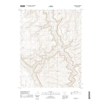
2019 Map of Juanita Arch
USGS Topo · Published 2019About this map
The Dolores River cuts a deep path through the canyonlands of western Mesa County in this 2019 survey, illustrating the complex drainage systems that define this part of the Colorado Plateau. High sandstone landforms such as Tenderfoot Mesa and Sewemup Mesa tower over the river valley, while the northern edge of the Sinbad Valley enters the frame at the southwestern corner. This area is characterized by dramatic topographic relief, where the namesake Juanita Arch sits tucked above Maverick Canyon. The map details a network of drainage features like Cottonwood Canyon and Salt Creek Canyon, alongside remote access routes such as 11 3/10 RD. These features highlight the isolated nature of the landscape and the importance of specific geological landmarks for navigation in the high desert.
Find a feature on this map
23 named features on this map. Tap any name to fly to it.
Don’t see what you’re looking for? This feature index may not catch every label — zoom into the map to look around manually.
Map Details
Editions of this 2019 Juanita Arch Map
This is the sole edition of this map. No revisions or reprints were ever made.
Other maps of this area

1885 · La Sal
USGS Topo · 1:250,000

1916 · Paradox Valley
USGS Topo · 1:125,000

1922 · Paradox Valley
USGS Topo · 1:125,000

1948 · Roc Creek
USGS Topo · 1:24,000

1949 · Roc Creek
USGS Topo · 1:24,000

1949 · Juanita Arch
USGS Topo · 1:24,000

1949 · Red Canyon
USGS Topo · 1:24,000

1949 · Calamity Mesa
USGS Topo · 1:24,000

1949 · Gateway
USGS Topo · 1:24,000

1950 · Juanita Arch
USGS Topo · 1:24,000