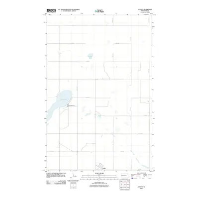
2011 Map of Juanita
USGS Topo · Published 2011About this map
Juanita sits at the base of this Foster County landscape, where the prairie begins to break into a series of significant water bodies. The hydrology of the area is anchored by Juanita Lake, which features the Juanita Outlet Control Dam at its southern end to manage local water levels. This 2011 survey captures the region's agricultural character, defined by a rigid grid of section-line roads like 10th St NE and 8th Ave. Beyond the small settlement, the terrain is dotted with substantial depressions including Round Lake and Stony Lake, while the seasonal flow of Baldhill Creek winds through the southeastern portion of the quadrangle. The map preserves the specific street layout of the townsite, including Viola St, providing a clear look at this rural community's footprint in the early 21st century.
Find a feature on this map
17 named features on this map. Tap any name to fly to it.
Don’t see what you’re looking for? This feature index may not catch every label — zoom into the map to look around manually.
Map Details
Editions of this 2011 Juanita Map
This is the sole edition of this map. No revisions or reprints were ever made.
Other maps of this area

1900 · Pingree
USGS Topo · 1:125,000

1944 · Brantford
USGS Topo · 1:62,500

1946 · Brantford
USGS Topo · 1:62,500

1949 · Grace City
USGS Topo · 1:24,000

1950 · Grace City
USGS Topo · 1:24,000

1950 · Brantford NE
USGS Topo · 1:24,000

1951 · Bordulac NE
USGS Topo · 1:24,000

1951 · Kensal NW
USGS Topo · 1:24,000

1951 · Glenfield
USGS Topo · 1:24,000

1952 · New Rockford
USGS Topo · 1:250,000