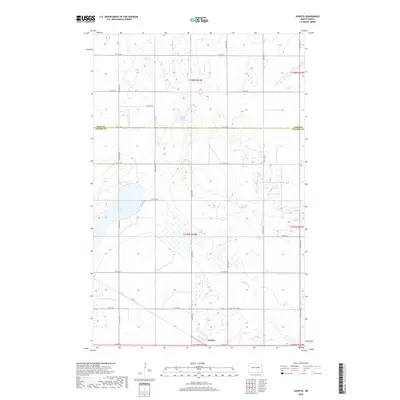
2018 Map of Juanita
USGS Topo · Published 2018About this map
Juanita sits at the intersection of Juanita Rd and 6th St NE in this section of Foster County, reflecting the sparse, agrarian grid of central North Dakota. The landscape is defined by its glacial hydrology, most prominently Juanita Lake, which occupies a significant portion of the western terrain. The surrounding prairie is dotted with smaller bodies of water like Round Lake and Stony Lake, which are characteristic of the prairie pothole region.
Find a feature on this map
24 named features on this map. Tap any name to fly to it.
Don’t see what you’re looking for? This feature index may not catch every label — zoom into the map to look around manually.
Map Details
Editions of this 2018 Juanita Map
This is the sole edition of this map. No revisions or reprints were ever made.
Other maps of this area

1900 · Pingree
USGS Topo · 1:125,000

1944 · Brantford
USGS Topo · 1:62,500

1946 · Brantford
USGS Topo · 1:62,500

1949 · Grace City
USGS Topo · 1:24,000

1950 · Grace City
USGS Topo · 1:24,000

1950 · Brantford NE
USGS Topo · 1:24,000

1951 · Bordulac NE
USGS Topo · 1:24,000

1951 · Kensal NW
USGS Topo · 1:24,000

1951 · Glenfield
USGS Topo · 1:24,000

1952 · New Rockford
USGS Topo · 1:250,000