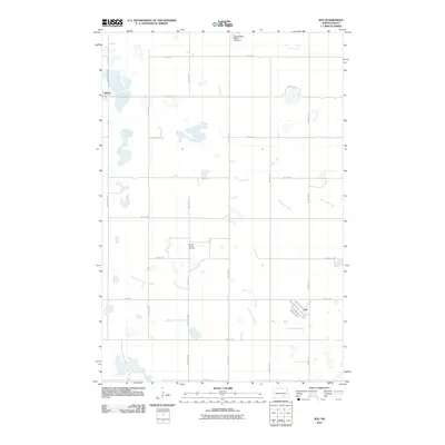
2011 Map of Jud
USGS Topo · Published 2011About this map
Jud and Alfred anchor this agricultural landscape in LaMoure County, reflecting the enduring grid of the Great Plains. The map highlights the localized water management and natural drainage systems of the region, specifically featuring the Lehr-Beglad-Henne Fish Dam to the north and the winding paths of Bone Hill Creek and Cottonwood Creek. These waterways dictate the placement of rural infrastructure, where section lines and county roads like County Rd 66 and County Rd 65 navigate around numerous prairie potholes and seasonal wetlands. For those tracing local heritage, the Church of God Cemetery stands as a primary landmark in the central part of the quadrangle. The street plan of Jud is clearly visible, including locally named routes like Ravely St and Miracle St, which contrast with the broad open spaces of the surrounding townships.
Find a feature on this map
30 named features on this map. Tap any name to fly to it.
Don’t see what you’re looking for? This feature index may not catch every label — zoom into the map to look around manually.
Map Details
Editions of this 2011 Jud Map
This is the sole edition of this map. No revisions or reprints were ever made.
Other maps of this area

1896 · Jamestown
USGS Topo · 1:125,000

1896 · Edgeley
USGS Topo · 1:125,000

1925 · Edgeley
USGS Topo · 1:125,000

1952 · Jud NW
USGS Topo · 1:24,000

1953 · Jamestown
USGS Topo · 1:250,000

1953 · Jud
USGS Topo · 1:24,000

1953 · Millarton
USGS Topo · 1:24,000

1953 · Jud SE
USGS Topo · 1:24,000

1956 · Jamestown
USGS Topo · 1:250,000

1982 · Schlecht-Weixel Dam
USGS Topo · 1:24,000