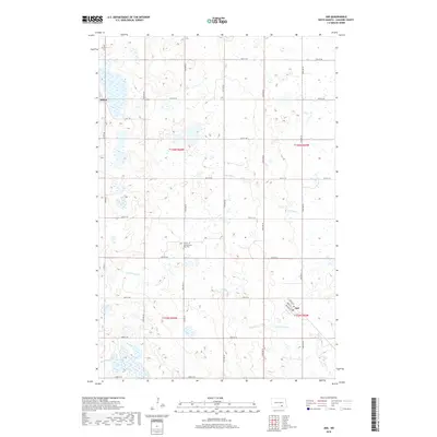
2018 Map of Jud
USGS Topo · Published 2018About this map
Jud and Alfred anchor this portion of LaMoure County, North Dakota, where the prairie landscape is defined by the regular grid of section lines and the winding paths of local waterways. The small town of Jud is detailed with street names including Ravely St, Logie St, and Johnson St, situated just north of where Cottonwood Cr crosses the township line. Further west, Alfred sits along the western edge of the quadrangle. A significant local landmark for genealogists and historians is the Church of God Seventh Day Cem, located centrally along 70th Ave SE. The terrain is characterized by numerous small wetlands and basins typical of the region, interspersed with drainage systems like Bone Hill Cr in the northern and eastern sections.
Find a feature on this map
28 named features on this map. Tap any name to fly to it.
Don’t see what you’re looking for? This feature index may not catch every label — zoom into the map to look around manually.
Map Details
Editions of this 2018 Jud Map
This is the sole edition of this map. No revisions or reprints were ever made.
Other maps of this area

1896 · Jamestown
USGS Topo · 1:125,000

1896 · Edgeley
USGS Topo · 1:125,000

1925 · Edgeley
USGS Topo · 1:125,000

1952 · Jud NW
USGS Topo · 1:24,000

1953 · Jamestown
USGS Topo · 1:250,000

1953 · Jud
USGS Topo · 1:24,000

1953 · Millarton
USGS Topo · 1:24,000

1953 · Jud SE
USGS Topo · 1:24,000

1956 · Jamestown
USGS Topo · 1:250,000

1982 · Schlecht-Weixel Dam
USGS Topo · 1:24,000