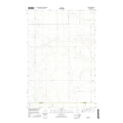
2014 Map of Jud NW
USGS Topo · Published 2014About this map
The county line between Stutsman Co and Lamoure Co bisects this section of the North Dakota prairie, revealing a landscape defined by its glacial hydrology and rectilinear section-line road network. Meandering drainage systems like Buffalo Cr and Cottontail Cr cut across the high plains, providing natural relief to the systematic grid of rural routes including 46th St SE and 73rd Ave SE. This survey reflects the enduring structure of the Great Plains township system, where the environment is characterized by numerous small prairie potholes and wetlands that dot the agricultural parcels between the gravel roads. The map captures a moment of modern topographic recording, documenting the precise elevation contours and water bodies that dictate the farming and drainage patterns of this rural region.
Find a feature on this map
17 named features on this map. Tap any name to fly to it.
Don’t see what you’re looking for? This feature index may not catch every label — zoom into the map to look around manually.
Map Details
Editions of this 2014 Jud NW Map
This is the sole edition of this map. No revisions or reprints were ever made.
Other maps of this area

1896 · Jamestown
USGS Topo · 1:125,000

1951 · Eldridge SE
USGS Topo · 1:24,000

1952 · Jud NW
USGS Topo · 1:24,000

1952 · Eldridge SW
USGS Topo · 1:24,000

1953 · Jamestown
USGS Topo · 1:250,000

1953 · Cleveland SE
USGS Topo · 1:24,000

1953 · Jud
USGS Topo · 1:24,000

1953 · Millarton
USGS Topo · 1:24,000

1953 · Jud SE
USGS Topo · 1:24,000

1956 · Jamestown
USGS Topo · 1:250,000