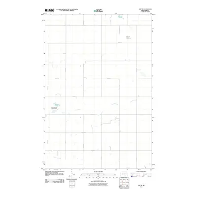
2011 Map of Jud SE
USGS Topo · Published 2011About this map
Bone Hill Creek carves a winding path across this section of LaMoure County, shaped by the Bone Hill Creek Diversion Dam which maintains the waters of Bone Hill Creek Lake. The landscape is a characteristically orderly grid of rural section roads, including County Rd 35, 55th St SE, and 77th Ave SE, reflecting the systematic agricultural development of the North Dakota prairie.
Find a feature on this map
20 named features on this map. Tap any name to fly to it.
Don’t see what you’re looking for? This feature index may not catch every label — zoom into the map to look around manually.
Map Details
Editions of this 2011 Jud SE Map
This is the sole edition of this map. No revisions or reprints were ever made.
Other maps of this area

1896 · Jamestown
USGS Topo · 1:125,000

1896 · Edgeley
USGS Topo · 1:125,000

1925 · Edgeley
USGS Topo · 1:125,000

1952 · Jud NW
USGS Topo · 1:24,000

1953 · Jamestown
USGS Topo · 1:250,000

1953 · Montpelier NW
USGS Topo · 1:24,000

1953 · Jud
USGS Topo · 1:24,000

1953 · Millarton
USGS Topo · 1:24,000

1953 · Nortonville
USGS Topo · 1:24,000

1953 · Jud SE
USGS Topo · 1:24,000
Featured Places
- Kenniston Township, ND
- Bluebird Township, ND
- Mikkelson Township, ND
- Glenmore Township, ND
- LaMoure County, ND