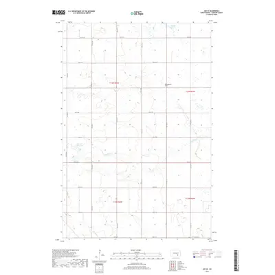
2018 Map of Jud SE
USGS Topo · Published 2018About this map
Wild Rice Slough and the expansive Minneapolis Flats define the geography of this rural LaMoure County landscape. The terrain is characterized by a high density of wetlands and depressions typical of the Missouri Coteau region, with water features such as Bone Hill Creek Lake and the meandering course of Bone Hill Cr and Cottonwood Cr draining the prairie. The human imprint is visible through the rigid section-line road system, including routes like 75th Ave SE and 60th St SE, which segment the townships of T136N R65W and T136N R64W. This 2018 survey illustrates the persistent agricultural grid of North Dakota, where the natural hydrology of sloughs and creeks continues to shape the placement of rural infrastructure and field boundaries.
Find a feature on this map
24 named features on this map. Tap any name to fly to it.
Don’t see what you’re looking for? This feature index may not catch every label — zoom into the map to look around manually.
Map Details
Editions of this 2018 Jud SE Map
This is the sole edition of this map. No revisions or reprints were ever made.
Other maps of this area

1896 · Jamestown
USGS Topo · 1:125,000

1896 · Edgeley
USGS Topo · 1:125,000

1925 · Edgeley
USGS Topo · 1:125,000

1952 · Jud NW
USGS Topo · 1:24,000

1953 · Jamestown
USGS Topo · 1:250,000

1953 · Montpelier NW
USGS Topo · 1:24,000

1953 · Jud
USGS Topo · 1:24,000

1953 · Millarton
USGS Topo · 1:24,000

1953 · Nortonville
USGS Topo · 1:24,000

1953 · Jud SE
USGS Topo · 1:24,000
Featured Places
- Kenniston Township, ND
- Bluebird Township, ND
- Mikkelson Township, ND
- Glenmore Township, ND
- LaMoure County, ND