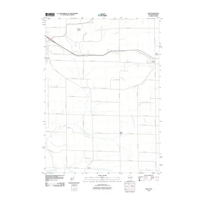
2010 Map of Juda
USGS Topo · Published 2010About this map
Juda and Twin Grove serve as the primary nodes of settlement in this rural landscape near the Illinois border. The area is characterized by a dense grid of local roads, such as Tschudy Rd and Town Center Rd, which connect family-named plots and historic burial grounds like Greenwood Cemetery, Mount Vernon Cemetery, and Johnson Cemetery. The hydrology of the region is defined by the headwaters of several streams, including the North Fork Juda Branch and East Branch Richland Creek, which drain the agricultural land between the major transport corridors. The presence of the Monroe Municipal Airport in the northwest corner highlights the modernization of local infrastructure alongside traditional land use. Genealogists and local historians can trace the continuity of land divisions and rural community centers that have remained central to this part of Green County for generations.
Find a feature on this map
46 named features on this map. Tap any name to fly to it.
Don’t see what you’re looking for? This feature index may not catch every label — zoom into the map to look around manually.
Map Details
Editions of this 2010 Juda Map
This is the sole edition of this map. No revisions or reprints were ever made.
Other maps of this area

1893 · Brodhead
USGS Topo · 1:62,500

1920 · Monroe
USGS Topo · 1:62,500

1922 · Monroe
USGS Topo · 1:62,500

1932 · Pecatonica
USGS Topo · 1:62,500

1936 · Pecatonica
USGS Topo · 1:62,500

1939 · Freeport
USGS Topo · 1:48,000

1944 · Freeport
USGS Topo · 1:62,500

1954 · Rockford
USGS Topo · 1:250,000

1955 · Rockford
USGS Topo · 1:250,000

1958 · Rockford
USGS Topo · 1:250,000