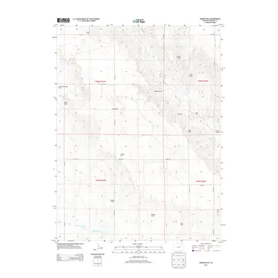
2013 Map of Judson Hills
USGS Topo · Published 2013About this map
Sunnyside School stands in the northern reach of this Morgan County landscape, an area characterized by a complex network of draws and canyons carving through the high plains. The terrain is defined by dramatic local relief, from the heights of Stony Point and Minter Hill to the deep depressions of Sterling Canyon and Whippie Canyon. Water management is central to the land's utility, evidenced by the Riverside Intake Canal and the Jackpot Ditch which service the Christensen Reservoir Number 1 and Whittington Reservoir. The eponymous Judson Hills sit at the center of a grid-like road system, including CO Road 10 and CO Road DD, illustrating the intersection of natural drainage patterns like Wildcat Creek with intentional rural development.
Find a feature on this map
36 named features on this map. Tap any name to fly to it.
Don’t see what you’re looking for? This feature index may not catch every label — zoom into the map to look around manually.
Map Details
Editions of this 2013 Judson Hills Map
This is the sole edition of this map. No revisions or reprints were ever made.
Other maps of this area

1951 · Weldona
USGS Topo · 1:24,000

1951 · Orchard
USGS Topo · 1:24,000

1951 · Sunken Lake
USGS Topo · 1:24,000

1951 · Peace Valley School
USGS Topo · 1:24,000

1951 · Judson Hills
USGS Topo · 1:24,000

1951 · Fort Morgan
USGS Topo · 1:24,000

1954 · Sterling
USGS Topo · 1:250,000

1954 · Greeley
USGS Topo · 1:250,000

1957 · Greeley
USGS Topo · 1:250,000

1958 · Greeley
USGS Topo · 1:250,000