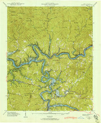
1940 Map of Judson
USGS Topo · Published 1940About this map
The Little Tennessee River and Tuckasegee River converge in this 1940 topographic study, a landscape on the verge of permanent change. The blue stipple on the map indicates areas intended for submergence by Fontana Lake at a pool elevation of 1710 feet, marking the future footprint of the reservoir. This includes the soon-to-be-displaced settlements of Judson, Bushnell, and Almond, which were then-active communities along the Southern Railway line.
Find a feature on this map
90 named features on this map. Tap any name to fly to it.
Don’t see what you’re looking for? This feature index may not catch every label — zoom into the map to look around manually.
Map Details
Editions of this 1940 Judson Map
This is the sole edition of this map. No revisions or reprints were ever made.
Other maps of this area

1886 · Knoxville
USGS Topo · 1:125,000

1891 · Cowee
USGS Topo · 1:125,000

1892 · Knoxville
USGS Topo · 1:125,000

1893 · Mt Guyot
USGS Topo · 1:125,000

1894 · Knoxville
USGS Topo · 1:125,000

1895 · Knoxville
USGS Topo · 1:125,000

1897 · Cowee
USGS Topo · 1:125,000

1901 · Knoxville
USGS Topo · 1:125,000

1907 · Cowee
USGS Topo · 1:125,000

1912 · Mt Guyot
USGS Topo · 1:125,000