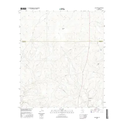
2016 Map of Julio Draw
USGS Topo · Published 2016About this map
The Menard Co Kimble Co line bisects this portion of the Edwards Plateau, where the landscape is defined by a dense network of seasonal drainages and ranching access. Intermittent waterways like Las Moras Cr and Big Saline Cr carve deep draws into the limestone terrain, creating a complex topography that has historically dictated the placement of roads and property boundaries.
Find a feature on this map
20 named features on this map. Tap any name to fly to it.
Don’t see what you’re looking for? This feature index may not catch every label — zoom into the map to look around manually.
Map Details
Editions of this 2016 Julio Draw Map
This is the sole edition of this map. No revisions or reprints were ever made.
Other maps of this area

1954 · Llano
USGS Topo · 1:250,000

1955 · Llano
USGS Topo · 1:250,000

1956 · Llano
USGS Topo · 1:250,000

1970 · San Augustine Draw
USGS Topo · 1:24,000

1970 · Julio Draw
USGS Topo · 1:24,000
1970 · Rust Ranch
USGS Topo · 1:24,000

1970 · Brewer Hollow
USGS Topo · 1:24,000

1970 · Elm Slough
USGS Topo · 1:24,000

1970 · East Elm Creek
USGS Topo · 1:24,000
1970 · Stark Creek
USGS Topo · 1:24,000