
1970 Map of San Augustine Draw
USGS Topo · Published 1973About this map
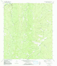
The San Saba River flows along the northern edge of this West Texas landscape, where the San Augustine Springs feed into a network of seasonal watercourses. The terrain is defined by its drainage patterns, notably the San Augustine Draw and Sheen Draw, which carve through the plateau. Local activity in 1970 was largely centered on ranching and resource extraction, evidenced by the numerous Gravel Pits and an Oil Well scattered across the central hills.
Find a feature on this map
16 named features on this map. Tap any name to fly to it.
Don’t see what you’re looking for? This feature index may not catch every label — zoom into the map to look around manually.
Map Details
Editions of this 1970 San Augustine Draw Map
2 editions found
Other maps of this area

1893 · Fort McKavett
USGS Topo · 1:125,000

1954 · Llano
USGS Topo · 1:250,000

1954 · Sonora
USGS Topo · 1:250,000

1955 · Llano
USGS Topo · 1:250,000

1956 · Llano
USGS Topo · 1:250,000

1958 · Sonora
USGS Topo · 1:250,000

1963 · McKegan Draw NE
USGS Topo · 1:24,000

1970 · Clear Creek Lake
USGS Topo · 1:24,000

1970 · Julio Draw
USGS Topo · 1:24,000
1970 · Rust Ranch
USGS Topo · 1:24,000