
1963 Map of McKegan Draw NE
USGS Topo · Published 1966About this map
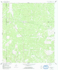
Lehne Ranch and several other family-owned estates define the rural landscape at the crossroads of Kimble, Menard, Sutton, and Schleicher Counties. This early 1960s survey documents a ranching-heavy economy characterized by vast acreage and scattered infrastructure. The local community center revolves around the Murr Ch, while specialized landmarks like a Landing Area near the Lopez Ranch and a Gravel Pit suggest the dual importance of aerial access and local materials for road maintenance in this territory. Numerous draws and waterways, including West Bear Creek and Middle Copperas Creek, provide the essential drainage for the Edwards Plateau terrain. The presence of multiple pipelines crossing the county lines highlights the role of energy infrastructure in this sparsely populated region of Texas.
Find a feature on this map
22 named features on this map. Tap any name to fly to it.
Don’t see what you’re looking for? This feature index may not catch every label — zoom into the map to look around manually.
Map Details
Editions of this 1963 McKegan Draw NE Map
2 editions found
Other maps of this area

1893 · Fort McKavett
USGS Topo · 1:125,000

1954 · Llano
USGS Topo · 1:250,000

1954 · Sonora
USGS Topo · 1:250,000

1955 · Llano
USGS Topo · 1:250,000

1956 · Llano
USGS Topo · 1:250,000

1958 · Sonora
USGS Topo · 1:250,000

1963 · McKegan Draw
USGS Topo · 1:24,000
1963 · Brokeleg Mountain
USGS Topo · 1:24,000
1963 · Coal Kiln Draw
USGS Topo · 1:24,000

1970 · San Augustine Draw
USGS Topo · 1:24,000