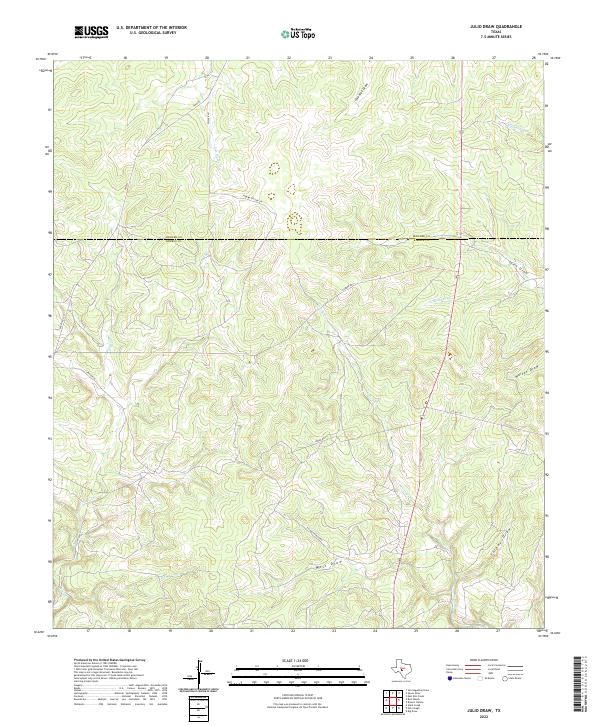
2022 Map of Julio Draw
USGS Topo · Published 2022About this map
The boundary between Menard County and Kimble County bisects this portion of the Texas Hill Country, defining a landscape of seasonal waterways and ranching corridors. The area is characterized by a series of significant drainages, including Gentry Creek and South Saline Creek, which cut through the undulating terrain alongside prominent topographical features like Julio Draw and Walton Draw. This 2022 survey illustrates the modern persistence of historic family-named routes and ranch access roads, such as Spiller Lane, Norma Spiller Lane, and Tillman Ranch Rd, which follow the natural contours of the land. The network of creeks including Las Moras Creek and Bear Creek highlights the drainage patterns essential to this semi-arid region's geography.
Find a feature on this map
20 named features on this map. Tap any name to fly to it.
Don’t see what you’re looking for? This feature index may not catch every label — zoom into the map to look around manually.
Map Details
Editions of this 2022 Julio Draw Map
This is the sole edition of this map. No revisions or reprints were ever made.
Other maps of this area

1954 · Llano
USGS Topo · 1:250,000

1955 · Llano
USGS Topo · 1:250,000

1956 · Llano
USGS Topo · 1:250,000

1970 · San Augustine Draw
USGS Topo · 1:24,000

1970 · Julio Draw
USGS Topo · 1:24,000
1970 · Rust Ranch
USGS Topo · 1:24,000

1970 · Brewer Hollow
USGS Topo · 1:24,000

1970 · Elm Slough
USGS Topo · 1:24,000

1970 · East Elm Creek
USGS Topo · 1:24,000
1970 · Stark Creek
USGS Topo · 1:24,000