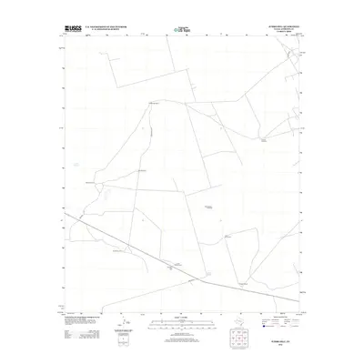
2012 Map of Jumbo Hill
USGS Topo · Published 2012About this map
Jumbo Hill rises above the arid plains of Andrews County, serving as a focal point for a landscape defined by ranching and vital water infrastructure. The distribution of family-named properties like McWhorter Ranch and Morgan Ranch illustrates the large-acreage land use typical of West Texas. This map provides a look at the essential water management of the region, featuring Scratch Springs and Jumbo Tank, alongside a dense network of wind-powered wells. These landmarks, including Harwell Windmill, Homesteader Windmill, and Kelly Windmill, reveal the persistence of traditional livestock watering methods. Local transportation is facilitated by named routes such as McWhorter Rd and Nelson Rd, which connect these isolated homesteads across the open terrain.
Find a feature on this map
16 named features on this map. Tap any name to fly to it.
Don’t see what you’re looking for? This feature index may not catch every label — zoom into the map to look around manually.
Map Details
Editions of this 2012 Jumbo Hill Map
This is the sole edition of this map. No revisions or reprints were ever made.
Other maps of this area

1954 · Hobbs
USGS Topo · 1:250,000

1958 · Hobbs
USGS Topo · 1:250,000

1969 · Hobbs SE
USGS Topo · 1:24,000

1969 · Eunice NE
USGS Topo · 1:24,000

1969 · Eunice SE
USGS Topo · 1:24,000

1971 · Brinson Ranch
USGS Topo · 1:24,000

1971 · Paynes Corner SE
USGS Topo · 1:24,000

1971 · Frankel City
USGS Topo · 1:24,000

1971 · Jumbo Hill
USGS Topo · 1:24,000

1971 · Whalen Lake
USGS Topo · 1:24,000