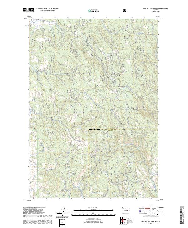
2023 Map of Jump-off Joe Mountain
USGS Topo · Published 2023About this map
Malheur National Forest dominates this high-country landscape along the border of Grant and Harney counties. This 2023 survey documents a complex network of hydrologic sources and drainage basins, including the headwaters of Antelope Creek and South Fork Antelope Creek in the north, and House Creek and Poison Creek to the south. The terrain is defined by several prominent peaks such as Jump-off Joe Mtn and Wolf Mtn, which overlook high-altitude clearings like Wolf Creek Meadow and Bridge Cr Meadow. Numerous named springs, including Kirkwood Spring, Bonde Spring, and Bear Wallow Spring, illustrate the critical water sources that sustain the local ecosystem and range. This modern topographic record captures the area's ongoing importance for forest management and natural resource protection, showing the intricate relationship between the elevated divides of Round Mtn and the branching flow of the West Fork Wolf Creek.
Find a feature on this map
45 named features on this map. Tap any name to fly to it.
Don’t see what you’re looking for? This feature index may not catch every label — zoom into the map to look around manually.
Map Details
Editions of this 2023 Jump-off Joe Mountain Map
This is the sole edition of this map. No revisions or reprints were ever made.
Other maps of this area

1955 · Burns
USGS Topo · 1:250,000

1955 · Canyon City
USGS Topo · 1:250,000

1958 · Burns
USGS Topo · 1:250,000

1959 · Burns
USGS Topo · 1:250,000

1959 · Canyon City
USGS Topo · 1:250,000

1961 · Calamity Butte
USGS Topo · 1:62,500

1961 · Logan Valley
USGS Topo · 1:62,500

1961 · Seneca
USGS Topo · 1:62,500

1968 · Van
USGS Topo · 1:62,500

1978 · John Day
USGS Topo · 1:100,000