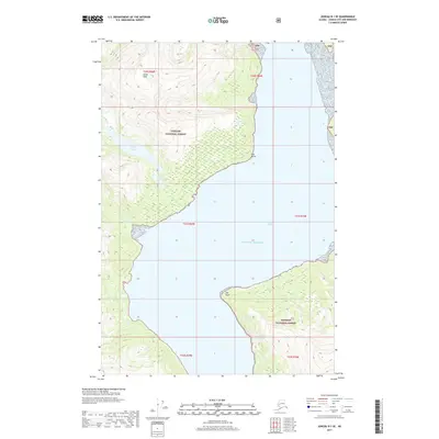
2017 Map of Juneau B-1 SE
USGS Topo · Published 2017About this map
Tongass National Forest dominates this coastal landscape, where steep maritime slopes meet the waters of Taku Inlet. The terrain is defined by dramatic elevation changes, rising from the Gulf of Alaska shoreline to the heights of Annex Peak. The hydrological network is centered on the Annex Lakes, which feed into Annex Cr before reaching the sea. This 2017 survey illustrates the complex coastline of the panhandle, featuring sheltered locations such as Sunny Cove and prominent landmarks like Flat Point and Jaw Point. To the south, Carlson Cr carves a path through the forest, marking the transition between rugged interior peaks and the tidal waters that have long served as the primary transit corridors for this part of Southeast Alaska.
Find a feature on this map
17 named features on this map. Tap any name to fly to it.
Don’t see what you’re looking for? This feature index may not catch every label — zoom into the map to look around manually.
Map Details
Editions of this 2017 Juneau B-1 SE Map
This is the sole edition of this map. No revisions or reprints were ever made.
Other maps of this area

1948 · Juneau B-1
USGS Topo · 1:63,360

1951 · Juneau
USGS Topo · 1:250,000

1951 · Taku River B-6
USGS Topo · 1:63,360

1951 · Taku River A-6
USGS Topo · 1:63,360

1951 · Juneau A-1
USGS Topo · 1:63,360

1952 · Juneau B-1
USGS Topo · 1:63,360

1953 · Taku River
USGS Topo · 1:250,000

1954 · Juneau A-1
USGS Topo · 1:63,360

1960 · Taku River
USGS Topo · 1:250,000

1962 · Juneau
USGS Topo · 1:250,000