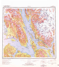
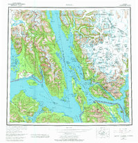
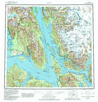
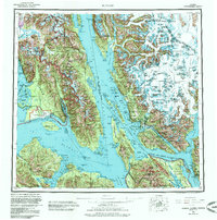
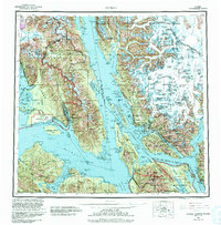
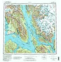
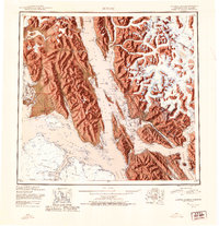
1962 Map of Juneau
USGS Topo · Published 1966About this map
Juneau and the surrounding Alexander Archipelago waterways appear here during a period of significant regional organization under the Greater Juneau Borough. The map captures the industrial and maritime footprint of Southeast Alaska, showing coastal settlements like the mining-legacy town of Treadwell and the fishing community of Hoonah. The sprawling Tongass National Forest dominates the terrestrial landscape, while the ice-carved reaches of Glacier Bay National Monument define the northwestern corner. This survey documents the complex network of sounds and straits, including Lynn Canal and Chatham Strait, which served as the primary highways for the region's commerce and transport. Inland, the height of the Coast Mountains along the United States-Canada border is marked by massive ice fields and peaks like Mount Nesselrode.
Find a feature on this map
152 named features on this map. Tap any name to fly to it.
Don’t see what you’re looking for? This feature index may not catch every label — zoom into the map to look around manually.
Map Details
Editions of this 1962 Juneau Map
7 editions found