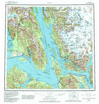
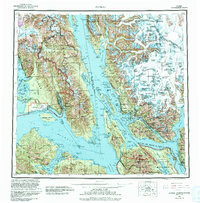
1962 Map of Juneau
USGS Topo · Published 1982About this map
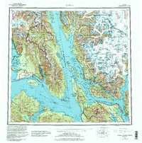
Juneau serves as the focal point of this coastal survey, situated where the Gastineau Channel separates the mainland from Douglas Island. The landscape is defined by the massive ice fields of the Coast Mountains, featuring the expansive Mendenhall Glacier and Taku Glacier. Mining history is deeply etched into the region, with the Treadwell and Alaska Juneau operations marked near the city, while remote prospects like Comet, Kensington, and Jualin dot the shores of Lynn Canal.
Find a feature on this map
301 named features on this map. Tap any name to fly to it.
Don’t see what you’re looking for? This feature index may not catch every label — zoom into the map to look around manually.
Map Details
Editions of this 1962 Juneau Map
7 editions found

Other maps of this area

1947 · Juneau B-3
USGS Topo · 1:63,360

1947 · Juneau B-2
USGS Topo · 1:63,360

1948 · Juneau C-5
USGS Topo · 1:63,360

1948 · Juneau B-4
USGS Topo · 1:63,360

1948 · Juneau A-3
USGS Topo · 1:63,360

1948 · Juneau B-6
USGS Topo · 1:63,360

1948 · Juneau C-4
USGS Topo · 1:63,360

1948 · Juneau A-4
USGS Topo · 1:63,360

1948 · Sitka D-1
USGS Topo · 1:63,360

1948 · Juneau C-6
USGS Topo · 1:63,360