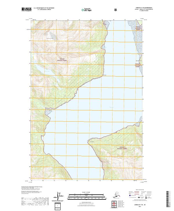
2021 Map of Juneau B-1 SE
USGS Topo · Published 2021About this map
Tongass National Forest encompasses the high ridgelines and glaciated valleys surrounding Taku Inlet, where steep mountain terrain drops sharply to the waterline. The landscape is defined by the significant drainage of Annex Cr and Carlson Cr, both feeding into sheltered coastal inlets like Greely Cove and the smaller Cove further south. This 2021 survey illustrates the dramatic topography of the Alaskan panhandle, centered on Annex Peak and the high-elevation waters of Annex Lakes. Distinct coastal landmarks including Davidson Point, Flat Point, and Jaw Point provide essential navigational reference for the tidal waters of the inlet. The map serves as a detailed record of the wilderness boundary between the forested slopes and the intricate shoreline of the Juneau area, capturing the natural hydrology and landform elevations before any significant human development has altered the immediate surroundings.
Find a feature on this map
17 named features on this map. Tap any name to fly to it.
Don’t see what you’re looking for? This feature index may not catch every label — zoom into the map to look around manually.
Map Details
Editions of this 2021 Juneau B-1 SE Map
This is the sole edition of this map. No revisions or reprints were ever made.
Other maps of this area

1948 · Juneau B-1
USGS Topo · 1:63,360

1951 · Juneau
USGS Topo · 1:250,000

1951 · Taku River B-6
USGS Topo · 1:63,360

1951 · Taku River A-6
USGS Topo · 1:63,360

1951 · Juneau A-1
USGS Topo · 1:63,360

1952 · Juneau B-1
USGS Topo · 1:63,360

1953 · Taku River
USGS Topo · 1:250,000

1954 · Juneau A-1
USGS Topo · 1:63,360

1960 · Taku River
USGS Topo · 1:250,000

1962 · Juneau
USGS Topo · 1:250,000