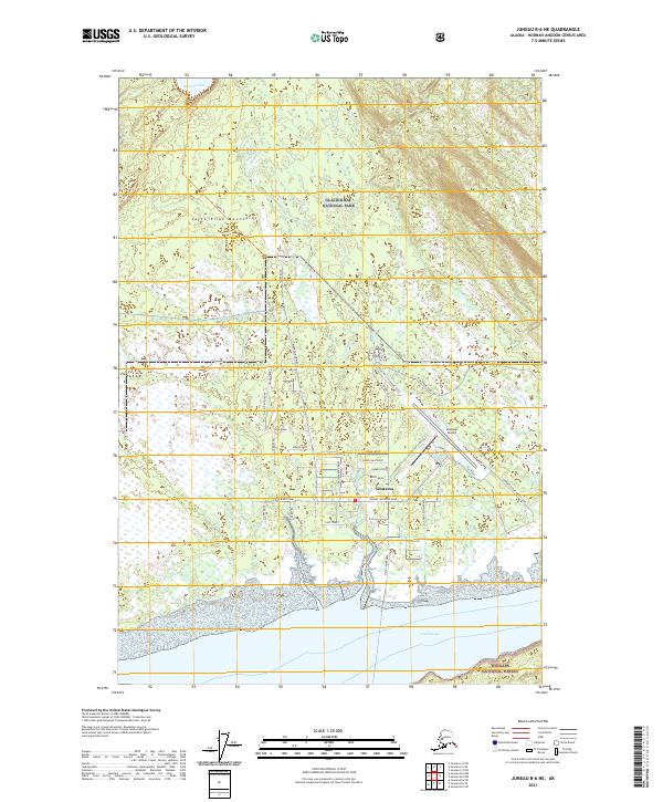
2021 Map of Juneau B-6 NE
USGS Topo · Published 2021About this map
Gustavus serves as a vital gateway on this coastal Alaskan landscape, situated where the Salmon River meets Icy Passage. The settlement is defined by its transition from the surrounding wilderness of Glacier Bay National Park and Tongass National Forest to a structured network of local roads and aviation infrastructure. The Gustavus Airport stands out as a primary focal point, supported by an intricate system of lanes such as Grandpa's Farm Road and Owen's Ditch Road, which suggest a community deeply connected to its local geography and history.
Find a feature on this map
39 named features on this map. Tap any name to fly to it.
Don’t see what you’re looking for? This feature index may not catch every label — zoom into the map to look around manually.
Map Details
Editions of this 2021 Juneau B-6 NE Map
This is the sole edition of this map. No revisions or reprints were ever made.
Other maps of this area

1948 · Juneau C-5
USGS Topo · 1:63,360

1948 · Juneau B-6
USGS Topo · 1:63,360

1948 · Juneau C-6
USGS Topo · 1:63,360

1948 · Juneau B-5
USGS Topo · 1:63,360

1950 · Juneau C-6
USGS Topo · 1:63,360

1950 · Juneau B-5
USGS Topo · 1:63,360

1951 · Juneau
USGS Topo · 1:250,000

1962 · Juneau
USGS Topo · 1:250,000
2015 · Juneau B-5 NW
USGS Topo · 1:25,000
2015 · Juneau B-6 NE
USGS Topo · 1:25,000