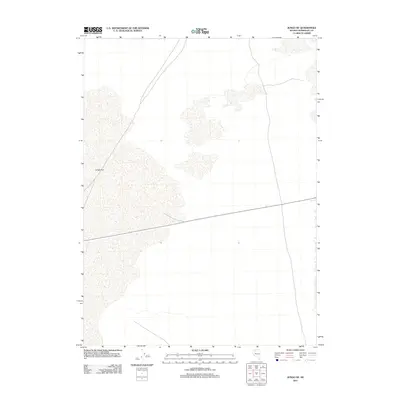
2011 Map of Jungo NE
USGS Topo · Published 2011About this map
Jungo Flat dominates this high-desert landscape in northern Nevada, characterized by an expansive alkaline basin and sparse drainage patterns. Located in Humboldt County, this 2011 survey by the U.S. Geological Survey illustrates the intersection of a solitary state route and the wide, unencumbered terrain of the Great Basin. The map's topographic contours and hydrographic data reflect a desert environment where water is a rare and defining element of the geography. For those studying the transit corridors of the American West, this sheet documents the modern road network as it crosses the arid expanse of the Nevada interior, highlighting the isolation of this region between more prominent mountain ranges.
Find a feature on this map
1 named feature on this map. Tap any name to fly to it.
Don’t see what you’re looking for? This feature index may not catch every label — zoom into the map to look around manually.
Map Details
Editions of this 2011 Jungo NE Map
This is the sole edition of this map. No revisions or reprints were ever made.
Other maps of this area

1886 · Disaster
USGS Topo · 1:250,000

1893 · Disaster
USGS Topo · 1:250,000

1931 · Lovelock
USGS Topo · 1:250,000

1935 · Lovelock
USGS Topo · 1:250,000

1939 · Eugene Mountains Area
USGS Topo · 1:62,500

1942 · Eugene Mountains Area
USGS Topo · 1:62,500

1954 · Vya
USGS Topo · 1:250,000

1955 · Lovelock
USGS Topo · 1:250,000

1958 · Vya
USGS Topo · 1:250,000

1959 · Lovelock
USGS Topo · 1:250,000