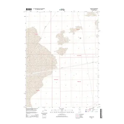
2014 Map of Jungo NE
USGS Topo · Published 2014About this map
Desert Valley dominates this arid landscape within Humboldt County, shown during a 2014 survey by the U.S. Geological Survey. The terrain is defined by its vast alluvial basins and the strategic placement of desert corridors. Modern infrastructure is represented by Jungo Rd, which cuts horizontally across the central basin, and Bottle Creek Rd, which navigates the northern reaches. These roads provide a rare glimpse into the logistical framework of a region primarily organized around the Public Land Survey System, as evidenced by the clearly marked township boundaries like t36n r33e and t35.5n r33e. The map illustrates the sparse but critical network of transportation routes required to traverse this expansive basin-and-range geography.
Find a feature on this map
9 named features on this map. Tap any name to fly to it.
Don’t see what you’re looking for? This feature index may not catch every label — zoom into the map to look around manually.
Map Details
Editions of this 2014 Jungo NE Map
This is the sole edition of this map. No revisions or reprints were ever made.
Other maps of this area

1886 · Disaster
USGS Topo · 1:250,000

1893 · Disaster
USGS Topo · 1:250,000

1931 · Lovelock
USGS Topo · 1:250,000

1935 · Lovelock
USGS Topo · 1:250,000

1939 · Eugene Mountains Area
USGS Topo · 1:62,500

1942 · Eugene Mountains Area
USGS Topo · 1:62,500

1954 · Vya
USGS Topo · 1:250,000

1955 · Lovelock
USGS Topo · 1:250,000

1958 · Vya
USGS Topo · 1:250,000

1959 · Lovelock
USGS Topo · 1:250,000