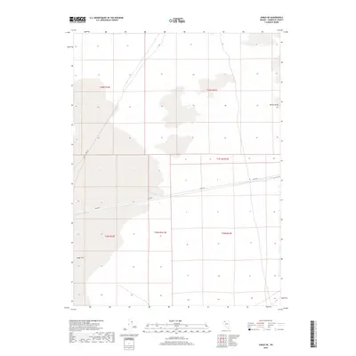
2018 Map of Jungo NE
USGS Topo · Published 2018About this map
Jungo Flat occupies the southwestern portion of this 2018 survey, reflecting the arid, expansive character of the northern Nevada landscape. This part of Humboldt County is defined by its isolation and the clear grid of the Public Land Survey System, which divides the terrain into distinct townships such as t36n r32e and t35n r33e. Transportation through this remote basin is facilitated by Jungo Rd, a primary artery that cuts across the flat towards the edge of Desert Valley. The intersection with Bottle Creek Rd represents one of the few navigational landmarks in a region largely characterized by its open, unpopulated flats and the subtle transitions between valley floors and surrounding township boundaries.
Find a feature on this map
11 named features on this map. Tap any name to fly to it.
Don’t see what you’re looking for? This feature index may not catch every label — zoom into the map to look around manually.
Map Details
Editions of this 2018 Jungo NE Map
This is the sole edition of this map. No revisions or reprints were ever made.
Other maps of this area

1886 · Disaster
USGS Topo · 1:250,000

1893 · Disaster
USGS Topo · 1:250,000

1931 · Lovelock
USGS Topo · 1:250,000

1935 · Lovelock
USGS Topo · 1:250,000

1939 · Eugene Mountains Area
USGS Topo · 1:62,500

1942 · Eugene Mountains Area
USGS Topo · 1:62,500

1954 · Vya
USGS Topo · 1:250,000

1955 · Lovelock
USGS Topo · 1:250,000

1958 · Vya
USGS Topo · 1:250,000

1959 · Lovelock
USGS Topo · 1:250,000