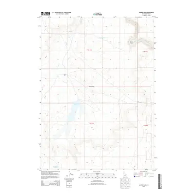
2013 Map of Juniper Basin
USGS Topo · Published 2013About this map
Juniper Basin Ranch sits near the headwaters of Juniper Cr, serving as a primary point of human habitation in this arid expanse of Owyhee County. The landscape is defined by the broad depression of Juniper Basin and the critical management of water, evidenced by infrastructure like the Juniper Basin Reservoir, Y P Reservoir Number 1, and Y P Reservoir Number 33. These catchments are essential for ranching operations in a high-desert environment where drainage is otherwise limited to seasonal flows and steep incisions. In the northeast, the terrain breaks sharply into Owyhee Canyon where the Owyhee River passes through, while Hole Up Canyon marks the northern edge of the basin. The presence of State Line Rd highlights the proximity to the state border, illustrating the isolated nature of these ranching lands in the early 21st century.
Find a feature on this map
14 named features on this map. Tap any name to fly to it.
Don’t see what you’re looking for? This feature index may not catch every label — zoom into the map to look around manually.
Map Details
Editions of this 2013 Juniper Basin Map
This is the sole edition of this map. No revisions or reprints were ever made.
Other maps of this area

1955 · McDermitt
USGS Topo · 1:250,000

1955 · Jordan Valley
USGS Topo · 1:250,000

1957 · Jordan Valley
USGS Topo · 1:250,000

1958 · Jordan Valley
USGS Topo · 1:250,000

1959 · McDermitt
USGS Topo · 1:250,000

1964 · Hat Peak
USGS Topo · 1:62,500

1971 · Juniper Basin SE
USGS Topo · 1:24,000

1971 · Juniper Basin
USGS Topo · 1:24,000
1971 · Jarvis Pasture
USGS Topo · 1:24,000

1971 · Ross Lake
USGS Topo · 1:24,000