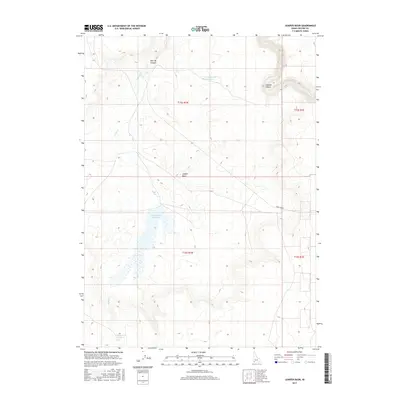
2017 Map of Juniper Basin
USGS Topo · Published 2017About this map
Juniper Basin dominates this corner of Owyhee County, characterized by a sparse network of water improvements and dramatic relief. The drainage of Juniper Cr feeds into the larger Juniper Basin Reservoir, a central water source in this high desert environment. To the northeast, the terrain drops sharply into the Owyhee Canyon, where the Owyhee River carves through the landscape. This 2017 survey reflects the enduring cattle-ranching infrastructure of the region, evidenced by isolated water storage sites like Y P Reservoir Number 1 and Y P Reservoir Number 33. Connectivity is limited to foundational routes such as State Line Rd, which skirts the border of the basin, and unnamed 4WD tracks that follow the ridgelines and canyon floors, including the aptly named Hole Up Canyon.
Find a feature on this map
13 named features on this map. Tap any name to fly to it.
Don’t see what you’re looking for? This feature index may not catch every label — zoom into the map to look around manually.
Map Details
Editions of this 2017 Juniper Basin Map
This is the sole edition of this map. No revisions or reprints were ever made.
Other maps of this area

1955 · McDermitt
USGS Topo · 1:250,000

1955 · Jordan Valley
USGS Topo · 1:250,000

1957 · Jordan Valley
USGS Topo · 1:250,000

1958 · Jordan Valley
USGS Topo · 1:250,000

1959 · McDermitt
USGS Topo · 1:250,000

1964 · Hat Peak
USGS Topo · 1:62,500

1971 · Juniper Basin SE
USGS Topo · 1:24,000

1971 · Juniper Basin
USGS Topo · 1:24,000
1971 · Jarvis Pasture
USGS Topo · 1:24,000

1971 · Ross Lake
USGS Topo · 1:24,000