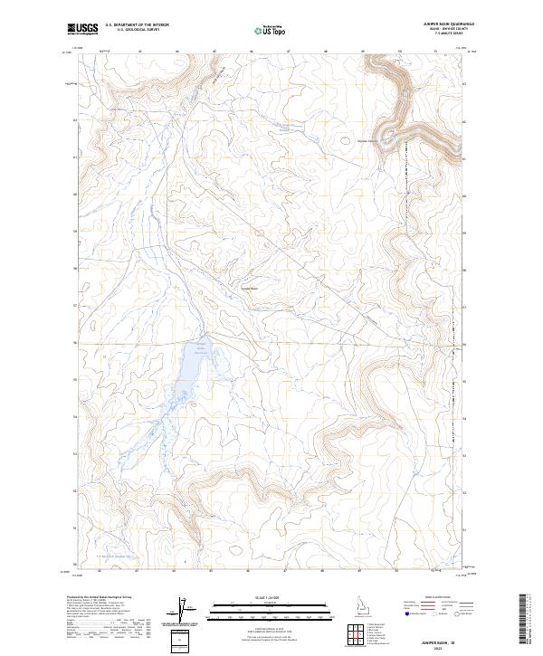
2023 Map of Juniper Basin
USGS Topo · Published 2023About this map
The Owyhee River Wilderness dominates the northern landscape of this Owyhee County borderland, where the deeply incised Owyhee Canyon guides the Owyhee Wild and Scenic River. This high desert environment is defined by its water management systems, characterized by the Juniper Basin Reservoir and the numerically designated stock ponds like Y P Reservoir Number 1 and Y P Reservoir Number 33. These reservoirs, connected by seasonal drainages such as Juniper Creek, trace the functional history of ranching in a territory where water is the primary architect of land use.
Find a feature on this map
16 named features on this map. Tap any name to fly to it.
Don’t see what you’re looking for? This feature index may not catch every label — zoom into the map to look around manually.
Map Details
Editions of this 2023 Juniper Basin Map
This is the sole edition of this map. No revisions or reprints were ever made.
Other maps of this area

1955 · McDermitt
USGS Topo · 1:250,000

1955 · Jordan Valley
USGS Topo · 1:250,000

1957 · Jordan Valley
USGS Topo · 1:250,000

1958 · Jordan Valley
USGS Topo · 1:250,000

1959 · McDermitt
USGS Topo · 1:250,000

1964 · Hat Peak
USGS Topo · 1:62,500

1971 · Juniper Basin SE
USGS Topo · 1:24,000

1971 · Juniper Basin
USGS Topo · 1:24,000
1971 · Jarvis Pasture
USGS Topo · 1:24,000

1971 · Ross Lake
USGS Topo · 1:24,000