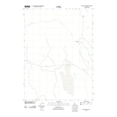
2010 Map of Juniper Basin SE
USGS Topo · Published 2010About this map
The Owyhee River snakes through this high desert region of southwestern Idaho, anchoring a landscape defined by ranching and remote infrastructure. Near the center of the sheet, the settlement of Pleasant Valley serves as a primary reference point, situated at the junction of the arterial Pleasant Valley Rd and Stateline Rd. This era of land use is characterized by livestock management and water access in an arid environment, evidenced by named landmarks such as the Dell Dick Windmill and Antelope Spring. To the northeast, the drainage patterns of Ross Slough interact with the river’s path, illustrating the complex hydrology of the basin floor. The map captures the quiet intersection of public rangelands and private holdings as they appeared in the early 21st century.
Find a feature on this map
7 named features on this map. Tap any name to fly to it.
Don’t see what you’re looking for? This feature index may not catch every label — zoom into the map to look around manually.
Map Details
Editions of this 2010 Juniper Basin SE Map
This is the sole edition of this map. No revisions or reprints were ever made.
Other maps of this area

1939 · Owyhee
USGS Topo · 1:62,500

1942 · Owyhee
USGS Topo · 1:62,500

1955 · McDermitt
USGS Topo · 1:250,000

1955 · Jordan Valley
USGS Topo · 1:250,000

1957 · Jordan Valley
USGS Topo · 1:250,000

1958 · Jordan Valley
USGS Topo · 1:250,000

1959 · McDermitt
USGS Topo · 1:250,000

1964 · Hat Peak
USGS Topo · 1:62,500

1971 · Juniper Basin SE
USGS Topo · 1:24,000

1971 · Juniper Basin
USGS Topo · 1:24,000