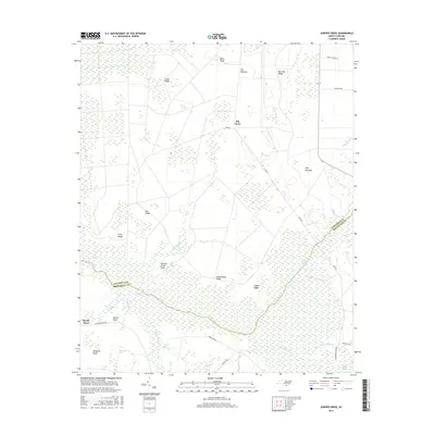
2016 Map of Juniper Creek
USGS Topo · Published 2016About this map
The Green Swamp dominates this landscape on the border of Columbus and Brunswick counties, where the natural environment is defined by a complex network of wetlands and low-lying ridges. The drainage patterns of Juniper Cr and Alligator Swamp dictate the movement through this area, which is characterized more by its terrain and timber history than by dense settlement. Pockets of dry land such as Schoolhouse Ridge, Clewis Ridge, and Cox Ridge provide high ground amidst the expansive swamp. Cultural landmarks like Ward Field and Bennett Little Field indicate the agricultural history of these openings, while the presence of Tram Rd and Carolina Ave reflect the infrastructure of local industry and rural life. Settlement remains sparse at the location of Big Curve and Myrtle Head, emphasizing the preserved character of this coastal plain ecosystem.
Find a feature on this map
37 named features on this map. Tap any name to fly to it.
Don’t see what you’re looking for? This feature index may not catch every label — zoom into the map to look around manually.
Map Details
Editions of this 2016 Juniper Creek Map
This is the sole edition of this map. No revisions or reprints were ever made.
Other maps of this area

1942 · Juniper Creek
USGS Topo · 1:24,000

1943 · Freeland
USGS Topo · 1:24,000

1943 · Honey Island
USGS Topo · 1:24,000

1943 · Exum
USGS Topo · 1:24,000

1943 · Supply
USGS Topo · 1:24,000

1944 · Supply
USGS Topo · 1:31,680
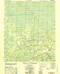
1950 · Supply
USGS Topo · 1:25,000

1953 · Florence
USGS Topo · 1:250,000

1954 · Florence
USGS Topo · 1:250,000

1954 · Bolton
USGS Topo · 1:62,500