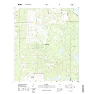
2018 Map of Juniper Springs
USGS Topo · Published 2018About this map
Juniper Springs and the surrounding Ocala National Forest define this landscape where groundwater systems meet protected pine scrub and wetlands. This late-stage survey details the hydrological network feeding into Lake George, including Silver Glen Springs and the secluded Fern Hammock Springs. The terrain is marked by distinct dry prairies such as Juniper Prairie and Farles Prairie, which contrast with the dense corridors along Juniper Creek. Cultural and recreational history is deeply embedded here, evidenced by The Yearling Trail on Pats Island—named for the Marjorie Kinnan Rawlings novel—and the extensive path of the Florida National Scenic Trail. In the southern reaches, the Pinecastle E.W. Range indicates the continued military utilization of this wilderness area, while local routes like John T. Childers Rd provide access to the various lake chains.
Find a feature on this map
36 named features on this map. Tap any name to fly to it.
Don’t see what you’re looking for? This feature index may not catch every label — zoom into the map to look around manually.
Map Details
Editions of this 2018 Juniper Springs Map
This is the sole edition of this map. No revisions or reprints were ever made.
Other maps of this area

1954 · Daytona Beach
USGS Topo · 1:250,000

1958 · Daytona Beach
USGS Topo · 1:250,000

1964 · Daytona Beach
USGS Topo · 1:250,000

1970 · Welaka SE
USGS Topo · 1:24,000

1970 · Salt Springs
USGS Topo · 1:24,000

1970 · Halfmoon Lake
USGS Topo · 1:24,000
1970 · Lake Kerr
USGS Topo · 1:24,000

1972 · Juniper Springs
USGS Topo · 1:24,000
1972 · Farles Lake
USGS Topo · 1:24,000
1972 · Astor
USGS Topo · 1:24,000