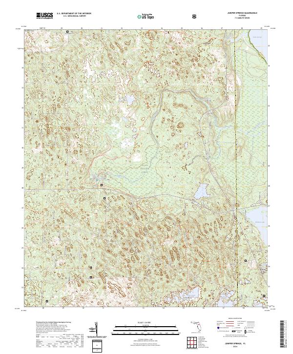
2024 Map of Juniper Springs
USGS Topo · Published 2024About this map
The Juniper Prairie Wilderness dominates this landscape within the larger Ocala National Forest, preserving a complex mosaic of hydrologic features and subtropical terrain. The area is defined by its remarkable spring systems, including the well-known Juniper Springs and the secluded Fern Hammock Springs, which feed into the meandering Juniper Creek as it flows toward the eastern boundary near Lake George. The presence of Long Cem and the settlement of Pats Island points to the early human footprint in this interior Florida scrubland.
Find a feature on this map
34 named features on this map. Tap any name to fly to it.
Don’t see what you’re looking for? This feature index may not catch every label — zoom into the map to look around manually.
Map Details
Editions of this 2024 Juniper Springs Map
This is the sole edition of this map. No revisions or reprints were ever made.
Other maps of this area

1954 · Daytona Beach
USGS Topo · 1:250,000

1958 · Daytona Beach
USGS Topo · 1:250,000

1964 · Daytona Beach
USGS Topo · 1:250,000

1970 · Welaka SE
USGS Topo · 1:24,000

1970 · Salt Springs
USGS Topo · 1:24,000

1970 · Halfmoon Lake
USGS Topo · 1:24,000
1970 · Lake Kerr
USGS Topo · 1:24,000

1972 · Juniper Springs
USGS Topo · 1:24,000
1972 · Farles Lake
USGS Topo · 1:24,000
1972 · Astor
USGS Topo · 1:24,000