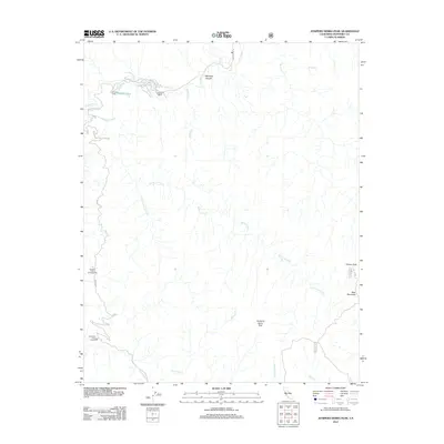
2012 Map of Junipero Serra Peak
USGS Topo · Published 2012About this map
Junipero Serra Peak dominates this section of the Santa Lucia Mountains, serving as a primary landmark for the network of canyons and creeks that define the Monterey County interior. The landscape is marked by remote recreation sites and private holdings, including the Abbott Ranch and the Girl Scout Camp located near the Abbott Lakes. A series of campgrounds such as Hanging Valley Campground and Escondido Camp Ground are accessible via seasonal paths like Indians Rd, illustrating the area's long-standing use for wilderness exploration. The complex drainage systems of Arroyo Seco and Santa Lucia Cr carve through the high elevations near Bear Mountain and Pinyon Peak, while smaller tributaries like Roosevelt Cr and Pinal Cr trace the deep contours of the terrain. This 2012 survey captures the specialized infrastructure of the national forest, from named peaks to the specific fire roads and trails that traverse Woodtick Canyon.
Find a feature on this map
19 named features on this map. Tap any name to fly to it.
Don’t see what you’re looking for? This feature index may not catch every label — zoom into the map to look around manually.
Map Details
Editions of this 2012 Junipero Serra Peak Map
This is the sole edition of this map. No revisions or reprints were ever made.
Other maps of this area

1915 · Soledad
USGS Topo · 1:62,500

1919 · Junipero Serra
USGS Topo · 1:62,500

1920 · Jamesburg
USGS Topo · 1:48,000

1921 · Jamesburg
USGS Topo · 1:62,500

1921 · Lucia
USGS Topo · 1:62,500

1939 · Jamesburg
USGS Topo · 1:62,500

1940 · Jamesburg
USGS Topo · 1:62,500

1940 · Soledad
USGS Topo · 1:62,500

1941 · Lucia
USGS Topo · 1:62,500

1941 · Junipero Serra
USGS Topo · 1:62,500