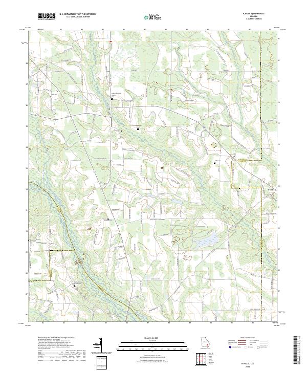
2024 Map of K'Ville
USGS Topo · Published 2024About this map
Big Satilla Creek and its many tributaries, including Sweetwater Creek and Colemans Creek, define the landscape of this rural Georgia terrain. The area is characterized by a dense network of family-named roads and remote religious sites, reflecting a deeply rooted community structure. K'Ville serves as a focal point near the eastern boundary, where the Appling Co Wayne Co line marks the jurisdictional divide.
Find a feature on this map
136 named features on this map. Tap any name to fly to it.
Don’t see what you’re looking for? This feature index may not catch every label — zoom into the map to look around manually.
Map Details
Editions of this 2024 K'Ville Map
This is the sole edition of this map. No revisions or reprints were ever made.
Other maps of this area

1953 · Waycross
USGS Topo · 1:250,000

1958 · Waycross
USGS Topo · 1:250,000
1971 · Odum
USGS Topo · 1:24,000

1971 · Surrency
USGS Topo · 1:24,000
1971 · Ritch
USGS Topo · 1:24,000

1971 · Coffee
USGS Topo · 1:24,000

1971 · K'ville
USGS Topo · 1:24,000

1971 · Patterson
USGS Topo · 1:24,000
1971 · Screven
USGS Topo · 1:24,000

1971 · Mershon
USGS Topo · 1:24,000