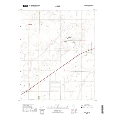
2018 Map of Kachina Point
USGS Topo · Published 2018About this map
Petrified Forest National Park dominates this landscape in northern Arizona, where the high desert is defined by its dramatic geological overlooks and historical travel routes. The map documents the northern reaches of the park, including the scenic Rim Trail and Tewa Trail that connect numerous observation points such as Kachina Point, Chinde Point, and Tiponi Point. These landmarks overlook the vast Lithodendron Wash, a drainage system that cuts through the arid terrain alongside smaller tributaries like Wildhorse Wash.
Find a feature on this map
28 named features on this map. Tap any name to fly to it.
Don’t see what you’re looking for? This feature index may not catch every label — zoom into the map to look around manually.
Map Details
Editions of this 2018 Kachina Point Map
This is the sole edition of this map. No revisions or reprints were ever made.
Other maps of this area

1886 · St Johns
USGS Topo · 1:250,000

1886 · Fort Defiance
USGS Topo · 1:250,000

1892 · Fort Defiance
USGS Topo · 1:250,000

1892 · St Johns
USGS Topo · 1:250,000

1912 · Petrified Forest
USGS Topo · 1:62,500

1954 · Saint Johns
USGS Topo · 1:250,000

1954 · Gallup
USGS Topo · 1:250,000

1955 · Petrified Forest
USGS Topo · 1:62,500

1956 · Adamana 1 NW
USGS Topo · 1:24,000

1957 · Saint Johns
USGS Topo · 1:250,000