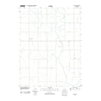
2009 Map of Kackley
USGS Topo · Published 2009About this map
The Republican River winds through the heart of this agricultural landscape in Republic County, serving as the primary drainage for a network of tributaries including Beaver Creek, School Creek, and Oak Creek. The settlement patterns here remain tied to the section-line grid, with the community of Norway situated along the eastern bank of the river and Kackley located further west.
Find a feature on this map
24 named features on this map. Tap any name to fly to it.
Don’t see what you’re looking for? This feature index may not catch every label — zoom into the map to look around manually.
Map Details
Editions of this 2009 Kackley Map
This is the sole edition of this map. No revisions or reprints were ever made.
Other maps of this area

1892 · Concordia
USGS Topo · 1:125,000

1955 · Manhattan
USGS Topo · 1:250,000

1956 · Manhattan
USGS Topo · 1:250,000

1957 · Manhattan
USGS Topo · 1:250,000

1965 · Concordia NW
USGS Topo · 1:24,000
1965 · Concordia
USGS Topo · 1:24,000

1965 · Kackley
USGS Topo · 1:24,000

1966 · Scandia
USGS Topo · 1:24,000
1966 · Scottsville
USGS Topo · 1:24,000
1966 · Jamestown
USGS Topo · 1:24,000