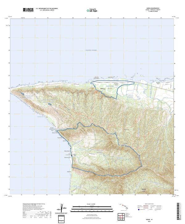
2024 Map of Kaena
USGS Topo · Published 2024About this map
Kaena Point Satellite Tracking Station dominates the westernmost tip of Oahu, a modern installation overlooking the Pacific Ocean and Yokohama Bay. The coastal landscape transitions from the sandy stretches of Mokule'ia Beach to the steep, sheer cliffs of the Wai'anae Range, including dramatic features like Alei Pali and Mahoe Pali.
Find a feature on this map
54 named features on this map. Tap any name to fly to it.
Don’t see what you’re looking for? This feature index may not catch every label — zoom into the map to look around manually.
Map Details
Editions of this 2024 Kaena Map
This is the sole edition of this map. No revisions or reprints were ever made.
Other maps of this area

1952 · Waimea
USGS Topo · 1:24,000

1953 · Haleiwa
USGS Topo · 1:24,000

1953 · Schofield Barracks
USGS Topo · 1:24,000

1954 · Oahu
USGS Topo · 1:250,000

1954 · Waianae
USGS Topo · 1:24,000

1954 · Kaena
USGS Topo · 1:24,000

1960 · Haleiwa
USGS Topo · 1:24,000

1960 · Schofield Barracks
USGS Topo · 1:24,000

1961 · Oahu
USGS Topo · 1:250,000
1963 · Waianae
USGS Topo · 1:24,000