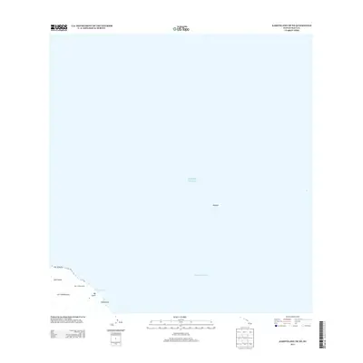
2013 Map of Kahoolawe OE NE
USGS Topo · Published 2013About this map
Hale 'O Papa Heiau stands as a significant landmark on the northeast coast of Kaho'olawe, overlooking the waters of the 'Alalākeiki Channel. This coastal section is defined by a series of geographic points and indentations, including Lae 'O Kuikui at the northern tip and the coastal entry of Hakioawa. Further inland, the volcanic landscape features the Lua 'O Keālialuna crater, while the drainage of Big Gulch reaches the sea near 'Oawawahie. To the northeast, the crescent-shaped island of Molokini sits isolated within the Pacific Ocean, serving as a primary navigational reference point between the larger islands. The map provides a precise record of the shoreline and traditional Hawaiian place names as they were cataloged in the early 21st century, offering a baseline for environmental and cultural studies of this protected island and its surrounding waters.
Find a feature on this map
10 named features on this map. Tap any name to fly to it.
Don’t see what you’re looking for? This feature index may not catch every label — zoom into the map to look around manually.
Map Details
Editions of this 2013 Kahoolawe OE NE Map
This is the sole edition of this map. No revisions or reprints were ever made.
Other maps of this area

1929 · Kahoolawe
USGS Topo · 1:62,500

1954 · Maui
USGS Topo · 1:250,000

1954 · Maalaea
USGS Topo · 1:24,000

1954 · Puu O Kali
USGS Topo · 1:24,000

1954 · Makena
USGS Topo · 1:24,000

1966 · Maui
USGS Topo · 1:250,000

1974 · Maui
USGS Topo · 1:250,000
1983 · Maalaea
USGS Topo · 1:24,000
1983 · Puu O Kali
USGS Topo · 1:24,000
1983 · Makena
USGS Topo · 1:24,000