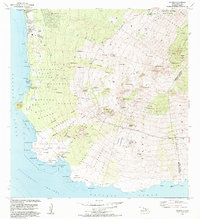
1983 Map of Makena
USGS Topo · Published 1984About this map
The coastal shelf of Southwest Maui is documented here in the early 1980s, revealing a landscape defined by sharp elevation changes from the Pacific Ocean up toward the volcanic slopes. The western coastline features the emerging resorts and residential areas of Wailea and Maui Meadows, while further south the terrain becomes more isolated. The Ahihi-Kinau Natural Area Reserve protects the volcanic shoreline around Cape Kinau and La Perouse Bay, where the historic Hanamanioa Light stands near Kaukioiakini Pond.
Find a feature on this map
75 named features on this map. Tap any name to fly to it.
Don’t see what you’re looking for? This feature index may not catch every label — zoom into the map to look around manually.
Map Details
Editions of this 1983 Makena Map
This is the sole edition of this map. No revisions or reprints were ever made.
Other maps of this area

1954 · Maui
USGS Topo · 1:250,000

1954 · Maalaea
USGS Topo · 1:24,000

1954 · Puu O Kali
USGS Topo · 1:24,000

1954 · Makena
USGS Topo · 1:24,000

1957 · Kilohana
USGS Topo · 1:24,000

1957 · Lualailua Hills
USGS Topo · 1:24,000

1966 · Maui
USGS Topo · 1:250,000

1974 · Maui
USGS Topo · 1:250,000
1983 · Lualailua Hills
USGS Topo · 1:24,000
1983 · Maalaea
USGS Topo · 1:24,000