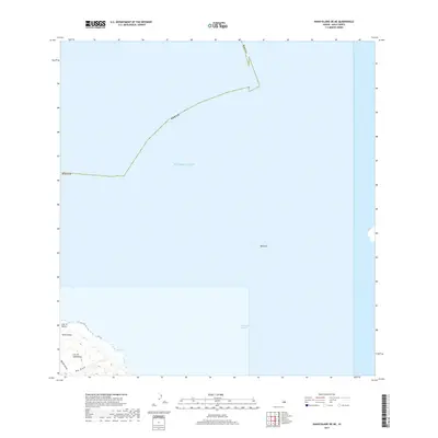
2017 Map of Kahoolawe OE NE
USGS Topo · Published 2017About this map
The crescent-shaped volcanic crater of Molokini stands as a prominent landmark within the 'Alalākeiki Channel, separating the islands of Maui and Kaho'olawe. This 2017 topographic survey highlights the northeastern coastal tip of Kaho'olawe, an area defined by significant topographic relief and maritime geography. On the island itself, the map identifies the peak of Lua 'O Keālialuna and the northern point at Lae 'O Kuikui. The shoreline is etched by drainage features including Big Gulch and Wa'aiki Gulch, which terminate near the historical area of Hakioawa. The survey provides a clear view of the bathymetry-adjacent terrain and the expansive reach of the Pacific Ocean surrounding these landforms, capturing the island's character in the early twenty-first century as part of Maui County.
Find a feature on this map
11 named features on this map. Tap any name to fly to it.
Don’t see what you’re looking for? This feature index may not catch every label — zoom into the map to look around manually.
Map Details
Editions of this 2017 Kahoolawe OE NE Map
This is the sole edition of this map. No revisions or reprints were ever made.
Other maps of this area

1929 · Kahoolawe
USGS Topo · 1:62,500

1954 · Maui
USGS Topo · 1:250,000

1954 · Maalaea
USGS Topo · 1:24,000

1954 · Puu O Kali
USGS Topo · 1:24,000

1954 · Makena
USGS Topo · 1:24,000

1966 · Maui
USGS Topo · 1:250,000

1974 · Maui
USGS Topo · 1:250,000
1983 · Maalaea
USGS Topo · 1:24,000
1983 · Puu O Kali
USGS Topo · 1:24,000
1983 · Makena
USGS Topo · 1:24,000